Wednesday, May 21, 2014

Fun SW swell and nice weather! YAY!


NOTE: I will be out of town through June 1st…try not to miss me! 

Whoa…where does the time go?  Fires!  Wild heat!  Crazy dry Santa Anas!  I hope everyone made it through that Solar Vortex unscathed.  At least there was some fun surf here and there if you weren’t evacuating or searching for air conditioning.  Thursday we’ve got some SW groundswell and WNW windswell swell backing off with funky waist high surf around most of SD County and slightly cleaner and waist/chest high surf in OC/LA.  We should see some very inconsistent SW sliding into town late Thursday but Friday is when it looks like that next SW groundswell will be starting to show.  Size picks up around most of So Cal into the waist/chest high range with some shoulder/HH in the northern parts of So Cal. Saturday a juicier SW swell makes it’s way into town and thanks to a nice steady storm down in the Southern Hemi it looks like we’ll have surf in the chest/shoulder high range Sunday, Monday and Tuesday in SD and a bit bigger especially on the sets for LA/OC.  The even better news is that it’ll become more consistent Sun and Mon and there’s another SW on its tail.  By Wed we should see another SW groundswell that will keep the surf up in the chest/shoulder high range in SD and shoulder/HH with some OH sets around town at the LA/OC breaks.  Looks like the southern hemi is waking up nicely and throwing us some love!

Weather wise we should see a little inclement weather tonight and through tomorrow before things clean up and we see some warmer air temps in the high 60s this weekend to mid 70s by midweek along the coast.  Winds will remain a little gusty for Thursday but will die down through the weekend and remain out of the SW.  It IS springtime after all.  Water temps are warming up into the low/mid 60s.  The 
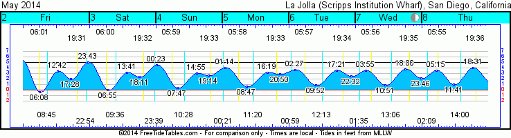
tides are pushing to a medium high in the early morning and backing out to a midday medium low before hitting the early evening high tide push around sunset.

Looks like some super fun surf!

Stay wet So Cal!
Mish


Tides for La Jolla (Scripps Institution Wharf) starting with May 22, 2014.

www.saltwatertides.com
Day        High      Tide  Height   Sunrise    Moon  Time      % Moon
           /Low      Time    Feet    Sunset                    Visible
 
Th  22     High   4:31 AM     4.0   5:46 AM    Rise  1:47 AM      46
    22      Low  10:57 AM     0.4   7:46 PM     Set  1:58 PM
    22     High   5:46 PM     4.8
 
F   23      Low  12:04 AM     1.3   5:45 AM    Rise  2:25 AM      35
    23     High   5:53 AM     3.9   7:47 PM     Set  3:00 PM
    23      Low  11:52 AM     0.6
    23     High   6:31 PM     5.2
 
Sa  24      Low   1:04 AM     0.6   5:45 AM    Rise  3:02 AM      25
    24     High   7:02 AM     3.9   7:47 PM     Set  4:02 PM
    24      Low  12:40 PM     0.8
    24     High   7:12 PM     5.6
 
Su  25      Low   1:54 AM     0.0   5:44 AM    Rise  3:41 AM      16
    25     High   8:01 AM     4.0   7:48 PM     Set  5:02 PM
    25      Low   1:24 PM     1.0
    25     High   7:50 PM     5.9
 
M   26      Low   2:37 AM    -0.5   5:44 AM    Rise  4:21 AM      9
    26     High   8:52 AM     4.0   7:49 PM     Set  6:02 PM
    26      Low   2:04 PM     1.2
    26     High   8:25 PM     6.0
 

Monday, May 12, 2014

Hot summer swells...!


Aloha!  I hope everyone had a great weekend and enjoyed the sizable WNW windswell.  We’re looking at the tail end of the windswell and for Tuesday we’ll see the start of the next SW groundswell.  Tuesday morning should see waist high surf at best and the long period SW will kick in late in the day.  Wednesday will see that steep SW.  Building swell starts at waist/chest with more chest/shoulder high sets by the end of the day at the better south facing beaches.  Thursday there will more consistent chest/shoulder high surf at the better summer spots.  Friday the swell starts to drop with a little NW windswell on top. Surf for Saturday looks smaller from the SW and more NW windswell in the thigh/waist high range. Sunday is more of that windswell with slightly bigger waist high waves.  There’s some nice activity down in the southern hemi.  Looks like more SW groundswell about 8 days out or so...the middle of next week.  

Hot, dry and more hot…that pretty much sums it up for the weather this week.  We’re looking at howling offshore Santa Anas all week with air temps in the mid to high 90s along the coast during the day and nighttime temps in the mid-60s.  Winds blowing out of the east and humidity dropping extremely low.  Things cool down to the mid80s by Friday, mid 70s Saturday and high 60s for Sunday.   Fire danger all week so be mindful of the dry conditions and stay hydrated.  Tides are pushing to a medium high mid-morning and down to a low mid-afternoon before pushing back up to a high tide after sunset.  Water temps are pretty nice and in the low to mid-60s.  I wouldn’t be surprised if the water temperature cooled down a few degrees after the Santa Anas blow offshore for a few days. 

Looks like hot summer conditions with some fun medium and fun summer swell.
Stay wet and hydrated So Cal!

Mish


Tonight’s sunset with San Clemente on the horizon.


Tides for La Jolla (Scripps Institution Wharf) starting with May 13, 2014.
www.saltwatertides.com
Day        High      Tide  Height   Sunrise    Moon  Time      % Moon
           /Low      Time    Feet    Sunset                    Visible

Tu  13      Low   3:06 AM    -0.5   5:51 AM     Set  5:06 AM      95
    13     High   9:19 AM     4.0   7:40 PM    Rise  6:50 PM
    13      Low   2:38 PM     1.2
    13     High   8:58 PM     5.9

W   14      Low   3:45 AM    -0.9   5:50 AM     Set  5:50 AM      98
    14     High  10:03 AM     4.0   7:40 PM    Rise  7:52 PM
    14      Low   3:13 PM     1.3
    14     High   9:32 PM     6.1

Th  15      Low   4:26 AM    -1.1   5:50 AM     Set  6:40 AM      99
    15     High  10:48 AM     4.0   7:41 PM    Rise  8:54 PM
    15      Low   3:50 PM     1.5
    15     High  10:10 PM     6.1

F   16      Low   5:10 AM    -1.2   5:49 AM     Set  7:36 AM      98
    16     High  11:37 AM     3.9   7:42 PM    Rise  9:53 PM
    16      Low   4:31 PM     1.6
    16     High  10:51 PM     6.0

Sa  17      Low   5:58 AM    -1.1   5:48 AM     Set  8:36 AM      94
    17     High  12:32 PM     3.8   7:43 PM    Rise 10:49 PM
    17      Low   5:19 PM     1.9
    17     High  11:38 PM     5.7

Thursday, May 8, 2014

South swells are a comin'!


Hey Ho Southies are on the way!  We’re seeing the tail end of a consistent WNW windswell for Thursday.  Waves in the waist high range with mediocre energy…not as juicy as the south swells that will show up later this week.  Friday looks like a smaller day with knee/waist high waves for most of the way with more of that wind bump on it.  A very long period and steep S groundswell will be starting to show on the buoys late Friday night.  By Saturday we should be seeing some more surf…still very inconsistent steep S to start the day, with waist/chest high sets.  The angle is not ideal for San Diego so head to your fav summer spots or to OC/LA area for the bigger sets.   On top of that south will be some WNW windswell.   Both swells fill in through the day with chest/shoulder high waves and sets in the HH range.   

Sunday will actually see more S swell so size will bump up to HH+ and OH sets especially at the south facing beaches.  Swell peaks mid-morning and then backs off quickly through the day. By the evening we will see waist/chest high sets with some fun energy still but just a little smaller.  Monday kicks off the week with the tail end of both swells and some waist high waves.  Tuesday will be more of the same with waist high waves out of the both the S and some similar sized NW windswell AND some pretty nice weather to boot!  The tail end of the day should see some new swell out of the steep south.  Wednesday looks to start off with inconsistent waist/chest waves bumping up at the best summer spots to chest/shoulder while the rest of the county hangs out with waist high waves with perhaps a bit of left over windswell.

We’ve got a whirlwind of weather on tap for the next week. The week ends with a little warming trend as we creep back up into the high 60s with a mix of clouds and sun for thru Sunday.  By Monday we’re going to see air temps in the high 80s again, drier humidity but winds mostly out of the N this time as the high sets up north of us.  Tuesday and Wed will see temps in the low 90s along the coast before cooling back down into the mid80s and high 70s.  Water temps should get a nice boost with these south swells and sunshine.  Right now it’s running in the low 60s in SD and high 50s low/60s in OC/LA.
Tides are pushing a medium high for the dawn patrol and backing down to a medium low midday before pushing up to a medium high around sunset.  Looks like conditions should be pretty nice for most of the next week’s worth of swells. 

A nice wave train setting up to deliver out of the south with some sunshine  the next week!

Stay wet So Cal!
Mish


Tides for La Jolla (Scripps Institution Wharf) starting with May 8, 2014.

www.saltwatertides.com
Day        High      Tide  Height   Sunrise    Moon  Time      % Moon
           /Low      Time    Feet    Sunset                    Visible
 
Th   8     High   5:14 AM     3.5   5:55 AM     Set  2:09 AM      56
     8      Low  11:41 AM     1.0   7:36 PM    Rise  2:00 PM
     8     High   6:32 PM     4.1
 
F    9      Low  12:36 AM     1.6   5:54 AM     Set  2:42 AM      66
     9     High   6:17 AM     3.6   7:37 PM    Rise  2:55 PM
     9      Low  12:22 PM     1.0
     9     High   7:00 PM     4.5
 
Sa  10      Low   1:16 AM     1.1   5:53 AM     Set  3:15 AM      74
    10     High   7:09 AM     3.8   7:38 PM    Rise  3:51 PM
    10      Low  12:57 PM     1.0
    10     High   7:27 PM     4.9
 
Su  11      Low   1:53 AM     0.5   5:53 AM     Set  3:49 AM      83
    11     High   7:54 AM     3.9   7:38 PM    Rise  4:48 PM
    11      Low   1:31 PM     1.0
    11     High   7:56 PM     5.2
 
M   12      Low   2:29 AM     0.0   5:52 AM     Set  4:26 AM      90
    12     High   8:37 AM     4.0   7:39 PM    Rise  5:48 PM
    12      Low   2:04 PM     1.1
    12     High   8:26 PM     5.6

Thursday, May 1, 2014

Small fun in the sun!


Hola amigos!  Another beautiful day in sunny So Cal.  Some fun peelers up and down the coast as well.  Lots of logging going on and fun beach break for those shorter boards.  Friday we should see the current SW fade a little through the day with waist/chest high waves that are fairly dependent on the tide.  Saturday it looks like a little less SW so mostly waist high peelers with the inconsistent chest high set at the better summer breaks.  Sunday the last of the SW will combo with some short period NW swell…not quite windswell but not good solid groundswell either.  Waist high waves for most of the day dropping off in size on Monday.  Monday will see thigh/waist high waves, fairly consistent but not a lot of energy.  Tuesday things should pick up a little as a WNW short period swell moves into town.  The day starts small with the knee/thigh high waves but pick up quickly through the day.  We should see some chest high waves by nightfall. 

Wednesday looks like the biggest day of the 7 day forecast with that shorter period WNW giving us some chest/shoulder high waves for most of the day as the swell peaks midday.    Size and energy back down Thursday but we’ll still see some fun chest high surf.  It looks like some long-period SW groundswell could make it our way a week or so out.  It’s got a bit of steep angle on it but there should be enough energy in that storm to give us a little love.  The northern hemi is looking pretty quiet as groundswells go and there’s a little lull in the southern hemi but I expect things to pick up a bit more down there. 

Weather wise we’re seeing some insanely beautiful sunny (and dry) skies this week and into the weekend.  Winds turned onshore this evening and is a nice relief from the dry heat of those Santa Anas.  We’ll still see sunny skies and air temps in the low 80s along the coast tomorrow.  Calm winds in the evening will be E Friday morning and then turning out of the W/SW in the afternoon.   Sat night and into Sunday we’ll see some pretty dense fog as the high pressure skips out of town.  Sunshine Sunday after the morning fog burns off and air temps in the low 70s.  Mid60s and a bit more cloudy with light/moderate SW winds for the first half of the week before it gets sunny and plenty warm again for the end of next week sliding into the weekend.  Water temps are warming back up with all of this sunshine…62-63 along the coast.  Pretty low tide for the dawn patrol but the upswing as it turns around and pushes to the medium high midday should be pretty fun. Then the tide swings back out to a medium low in the early evening before sunset.

Nothing huge but some fun surf and great weather ahead of us!  Stay wet So Cal!

Mish

 Tonight's sunset behind San Clemente Island

Tides for La Jolla (Scripps Institution Wharf) starting with May 2, 2014.

www.saltwatertides.com
Day        High      Tide  Height   Sunrise    Moon  Time      % Moon
           /Low      Time    Feet    Sunset                    Visible
 
F    2      Low   6:08 AM    -0.4   6:00 AM    Rise  8:45 AM      7
     2     High  12:42 PM     3.4   7:32 PM     Set 10:55 PM
     2      Low   5:29 PM     2.1
     2     High  11:43 PM     5.0
 
Sa   3      Low   6:54 AM     0.0   6:00 AM    Rise  9:36 AM      13
     3     High   1:41 PM     3.2   7:32 PM     Set 11:40 PM
     3      Low   6:12 PM     2.4
 
Su   4     High  12:24 AM     4.5   5:59 AM    Rise 10:28 AM      20
     4      Low   7:47 AM     0.4   7:33 PM
     4     High   2:55 PM     3.1
     4      Low   7:14 PM     2.7
 
M    5     High   1:15 AM     4.1   5:58 AM     Set 12:22 AM      28
     5      Low   8:48 AM     0.7   7:34 PM    Rise 11:21 AM
     5     High   4:19 PM     3.2
     5      Low   8:49 PM     2.8
 
Tu   6     High   2:27 AM     3.7   5:57 AM     Set  1:00 AM      37
     6      Low   9:53 AM     0.9   7:35 PM    Rise 12:13 PM
     6     High   5:23 PM     3.5
     6      Low  10:31 PM     2.6