Thursday, July 31, 2014

More SW swell on the way!


Happy August everyone!  The weather’s heating up and it looks like the SW swells are too!  Friday we’re looking at some combo WNW windswell and WSW swell building through the day.  Surf starts out in the waist high range and bumps up to the waist/chest high range with some shoulder high sets late in the day at the better north facing spots.  Saturday will see more of the same waist/chest with slightly bigger sets at the better NW facing spots.  OC/LA will see slightly less of this first swell with more of the WNW showing but some smaller SW squeaking through.  Sunday things taper off early with some residual WNW and WSW on the books. 

Late Sunday is when the next SW groundswell makes it to our swell window.  By Monday morning we’re looking at waist/chest high waves out of the SW in SD and slightly bigger in OC and LA.  Swell peaks late Monday with some fun chest/shoulder high surf along the coast with the best (i.e. bigger) surf at the hot summer spots.  Tuesday sees the back end of that SW swell with waist/chest high surf.  The good news is that the next juicy swell will be showing up late Tuesday and filling in Wed.  Looks like a nice one too…good SW angle and lots of energy.  SD will be seeing solid chest/shoulder high waves by Wed morning and OC will be seeing some shoulder/HH with some OH sets no doubt.  Swell builds with some additional SW adding on late Wed and into Thursday.  Surf looks to be biggest early as the two swells collide…HH/OH along most of the So Cal coast.  Looks like a few more storms brewing down south. Hopefully they’ll pop out from behind Oz and NZ with plenty of energy!

Weather wise we’re looking at more hot and humid weather for a while.  Air daytime temps in the high 70s/low 80s along the coast, humid and a bit more clouds over the weekend.  We also have a slight chance of thunderstorms along the coast.  Of course, last time we had a “chance” of thunderstorms I was dodging lightning bolts at the beach so we’ll see how that pans out.  Winds will also pick up out of the SW over Friday and the weekend as those thunderstorms move in.  We get back to normal westerly winds during the week. Things don’t cool off until next weekend so be ready for HOT.  Water temps are deliciously warm with 72-75 readings along So Cal.  As we come off the New Moon we see a medium low for the dawn patrol, an early afternoon high and then out to a medium low around sunset.

The fun’s about to start!  Giddy up and stay wet So Cal!

Mish


Tonight's sunset from Cardiff by the Sea, CA

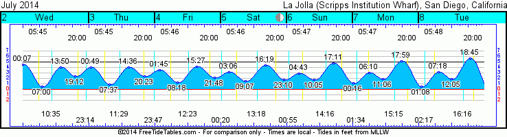
Tides for La Jolla (Scripps Institution Wharf) starting with August 1, 2014.

www.saltwatertides.com
Day        High      Tide  Height   Sunrise    Moon  Time      % Moon
           /Low      Time    Feet    Sunset                    Visible
 
F    1     High  12:21 AM     4.1   6:03 AM    Rise 11:11 AM      20
     1      Low   6:41 AM     1.1   7:48 PM     Set 10:56 PM
     1     High   1:26 PM     4.4
     1      Low   7:35 PM     2.0
 
Sa   2     High   1:10 AM     3.7   6:04 AM    Rise 12:07 PM      28
     2      Low   7:13 AM     1.6   7:47 PM     Set 11:32 PM
     2     High   2:12 PM     4.4
     2      Low   8:54 PM     2.0
 
Su   3     High   2:26 AM     3.1   6:04 AM    Rise  1:04 PM      38
     3      Low   7:55 AM     1.9   7:46 PM
     3     High   3:11 PM     4.6
     3      Low  10:26 PM     1.6
 
M    4     High   4:17 AM     2.9   6:05 AM     Set 12:12 AM      48
     4      Low   9:01 AM     2.2   7:45 PM    Rise  2:03 PM
     4     High   4:18 PM     4.9
     4      Low  11:45 PM     1.2
 
Tu   5     High   6:00 AM     3.0   6:06 AM     Set 12:57 AM      58
     5      Low  10:28 AM     2.4   7:44 PM    Rise  3:03 PM
     5     High   5:23 PM     5.2

Thursday, July 24, 2014

Mostly small NW windswell...some SW


Daaaaaaang, when you’re under the weather time flies fast!  Getting back into the groove of things…now, where’s the surf?  It doesn’t look like we’re going to see much any time soon.  We’re seeing the tail end of that last SW mixed with some left over NW windswell.  Friday will be the smallest day with the least of both swells.  We’re looking at knee high around most of town.  At the end of the day we may start to see some S on the buoys but the angle is all wrong for So Cal as it will fly by SD, OC and LA.  Saturday a mild WNW windswell will fill in so we’ll see some short period, low energy waves in the waist high range.  That holds through Sunday and really most of Monday. 

On the backside of Monday a new SW will fill in through the night.  This one has a slightly better angle so the better summer spots will see a bit more swell by Tuesday.  The summer spots will see waist high surf with the occasional chest high set…inconsistent at first light but should fill in a bit as the day progresses.  Wednesday sees a bit more of the same with a little more consistency and things back off a hair Thursday and into Friday.  By Friday the angle will be pretty steep and miss most of SD but OC/LA should see some lingering waves.  The northern hemi has some interesting typhoon action going on and we may see some W swell a week and a half or so in the future.  There’s a juicy storm coming out of the Indian Ocean that will send New Zealand some macking swell and will hopefully stick around long enough to swing up in our direction and send us some swell.

Weather wise we’re looking at patchy morning fog that will burn off along the coast and leave us with some hot and fairly humid weather.  Air temps in the high 70s through the weekend with a bit more sunshine by Sunday.  Winds out of the SE early Friday to SW by midday and then S again for Saturday.  Back to out more normal wind pattern for Sunday with calm nighttime and a bit of west wind by midday to cool things off.  Water temps have fluctuated a bit and range from 69-73 along the coast.  Tides are low in the wee hours of the dawn patrol and head up to a medium high late morning and then back down to a medium low mid-afternoon before heading to a late evening high an hour or so after sunset.  The new moon is Sunday.

Looks like some pretty small surf but decent conditions for a nice swim or just a fun day at the beach!  Enjoy it and stay wet So Cal!

Mish

 Tides for La Jolla (Scripps Institution Wharf) starting with July 25, 2014.

www.saltwatertides.com
Day        High      Tide  Height   Sunrise    Moon  Time      % Moon
           /Low      Time    Feet    Sunset                    Visible
 
F   25      Low   3:27 AM    -0.4   5:58 AM    Rise  4:59 AM      4
    25     High   9:53 AM     4.0   7:53 PM     Set  6:56 PM
    25      Low   2:50 PM     1.9
    25     High   9:02 PM     5.9
 
Sa  26      Low   3:55 AM    -0.4   5:59 AM    Rise  5:52 AM      1
    26     High  10:20 AM     4.1   7:52 PM     Set  7:35 PM
    26      Low   3:24 PM     1.8
    26     High   9:34 PM     5.8
 
Su  27      Low   4:23 AM    -0.3   5:59 AM    Rise  6:45 AM      0
    27     High  10:47 AM     4.2   7:51 PM     Set  8:11 PM
    27      Low   3:58 PM     1.7
    27     High  10:06 PM     5.6
 
M   28      Low   4:50 AM    -0.2   6:00 AM    Rise  7:37 AM      0
    28     High  11:15 AM     4.2   7:51 PM     Set  8:45 PM
    28      Low   4:32 PM     1.7
    28     High  10:37 PM     5.4
 
Tu  29      Low   5:17 AM     0.1   6:01 AM    Rise  8:30 AM      3
    29     High  11:44 AM     4.3   7:50 PM     Set  9:17 PM
    29      Low   5:08 PM     1.8
    29     High  11:09 PM     5.1

Monday, July 7, 2014

End of steep south and small SW on the way


Alrighty then!  We’re seeing the tail end of the swath of steep souths that peaked yesterday but will dip only slightly on Tuesday.  Still plenty of steep south but seen really only at the best summer breaks in SD County and North County SD.  The best stuff (that we’ll see in the mags) is found north of Dana Point in the OC area.  SD is looking at waist high around most of the county with the summer spots and North County spots seeing some chest/shoulder high waves.  OC will still see plenty of HH/OH waves for Tuesday and LA will be slightly smaller if you head too far north.  Wed we’re still waking up to steep south but by nightfall it will have dropped off a foot or so.  Thursday looks like a mix of small NW windswell and the tail end of S swell.  Look for most of So Cal to be seeing waist high waves with chest high in the northern regions. 

Friday and into Sat look like the smallest days with knee/waist high around SD and waist high in OC and LA.  Some NW windswell will give SD some consistent but small waves as the S poops out.  Some new SW swell with great angle for most of So Cal looks to fill in late Sat and into Sun.  Unfortunately the energy isn’t quite as good as this last swell so look for mostly waist with the occasional chest high set for Sun and Monday.  This swell will combo with more WNW windswell so most spots in SD will continues to see waist high through Tuesday and slightly smaller for with less influence from the NW windswell in the OC/LA areas.  Unfortunately Tropical Storm Fausto is heading NW and is well out of our swell window.  Hawaii should pick up some fun South Shore swell though if you’re heading in that direction.  In fact, Hawaii is getting a much more direct hit from all of these south swells lately.  So jealous!

Weather will cool down a bit through the week with daytime air temps in the mid-70s along the coast and mid-60s at night with some patchy fog in the early morning and late night.  A little south wind tonight may put a little bump on the water for the morning and through Tuesday but otherwise calm mornings and light onshore winds by the afternoon for the rest of the work week.  Tides are hitting a medium high in the early morning with a medium low midday and back up to a very high tide in the late evening.  The Full Moon is this Saturday…watch out for crazies!  The best news is that the water is an incredible 71-73.5 degrees which is extremely warm (and nice) for July.  Should be interesting to see what September Sessions hold!

Still plenty of fun waves!  Stay wet So Cal!
Mish


Tides for La Jolla (Scripps Institution Wharf) starting with July 8, 2014.

www.saltwatertides.com
Day        High      Tide  Height   Sunrise    Moon  Time      % Moon
           /Low      Time    Feet    Sunset                    Visible
 
Tu   8      Low   1:08 AM     0.5   5:48 AM     Set  2:17 AM      73
     8     High   7:19 AM     3.2   8:00 PM    Rise  4:18 PM
     8      Low  12:05 PM     2.0
     8     High   6:45 PM     5.7
 
W    9      Low   1:53 AM    -0.2   5:48 AM     Set  3:06 AM      82
     9     High   8:12 AM     3.6   8:00 PM    Rise  5:20 PM
     9      Low  12:59 PM     1.9
     9     High   7:30 PM     6.2
 
Th  10      Low   2:35 AM    -0.8   5:49 AM     Set  4:02 AM      90
    10     High   8:58 AM     3.9   8:00 PM    Rise  6:20 PM
    10      Low   1:50 PM     1.7
    10     High   8:16 PM     6.5
 
F   11      Low   3:17 AM    -1.3   5:49 AM     Set  5:03 AM      96
    11     High   9:41 AM     4.1   8:00 PM    Rise  7:18 PM
    11      Low   2:39 PM     1.6
    11     High   9:01 PM     6.8
 
Sa  12      Low   3:59 AM    -1.5   5:50 AM     Set  6:10 AM      99
    12     High  10:23 AM     4.4   7:59 PM    Rise  8:11 PM
    12      Low   3:28 PM     1.5
    12     High   9:47 PM     6.8
 

Saturday, July 5, 2014

Really steep S!


Quick update!  Looks like the next south swell is here but the big energy is flying past SD County and making landfall past Dana Point in the OC and LA areas.  SD will see some limited and VERY inconsistent chest/shoulder high surf with the standout summer spots seeing some HH surf.  Remember…it’s a very long period swell…very inconsistent for Sunday as it picks up through the day.  North of Dana Pt. will see inconsistent but bigger surf in the HH/OH range all day as it peaks later in the day.  For Monday we’re still seeing plenty of swell as it starts to back off but is more consistent.   Tuesday the swell backs off further but still some fun surf up and down the coast in the chest/shoulder high range as a new steep S swell fills in.  Lots more details tomorrow!

Water’s awesome at 70-71 degrees. Sunshine for most of Sunday with a high in the mid-70s and patchy fog moving in late Sunday night and early Monday.  Calm and clean in the AM and mild west wind in the afternoon.  Slightly cooler through the week but still nice and always worth a paddle out!  Medium high at the crack of dawn going to a medium low then back up again to a high in the late afternoon. 

Full week’s update tomorrow…have fun and don’t forget the SPF!
Stay wet So Cal!
Mish
 

Tides for La Jolla (Scripps Institution Wharf) starting with July 6, 2014.

Day        High      Tide  Height   Sunrise    Moon  Time      % Moon
           /Low      Time    Feet    Sunset                    Visible
 
Su   6     High   4:44 AM     2.9   5:47 AM     Set 12:56 AM      53
     6      Low  10:03 AM     1.8   8:01 PM    Rise  2:16 PM
     6     High   5:10 PM     4.8
 
M    7      Low  12:17 AM     1.2   5:47 AM     Set  1:34 AM      63
     7     High   6:12 AM     3.0   8:01 PM    Rise  3:16 PM
     7      Low  11:06 AM     1.9
     7     High   5:58 PM     5.2
 
Tu   8      Low   1:08 AM     0.5   5:48 AM     Set  2:17 AM      73
     8     High   7:19 AM     3.2   8:00 PM    Rise  4:18 PM
     8      Low  12:05 PM     2.0
     8     High   6:45 PM     5.7
 
W    9      Low   1:53 AM    -0.2   5:48 AM     Set  3:06 AM      82
     9     High   8:12 AM     3.6   8:00 PM    Rise  5:20 PM
     9      Low  12:59 PM     1.9
     9     High   7:30 PM     6.2
 
Th  10      Low   2:35 AM    -0.8   5:49 AM     Set  4:02 AM      90
    10     High   8:58 AM     3.9   8:00 PM    Rise  6:20 PM
    10      Low   1:50 PM     1.7
    10     High   8:16 PM     6.5
 

Tuesday, July 1, 2014

South swell is coming!!!


Yeh baby! Here some our summer swells!  We have the tail end of that WNW and SW swells in the water for Wednesday with waist high waves along most of the counties beaches.  Late in the day and into Thursday morning we will start to see the next SW swell combined with a more shorter period NW ground swell.  The SW builds all day Thursday and into Friday.  We’ll start with waist high super inconsistent surf and it’ll make its way up to chest/shoulder high at SD County summer spots and shoulder/HH by nightfall at breaks in OC and LA.  Looks like Tropical Storm Dougie will be throwing some swell in our general direction.  I think it’ll mostly fly by us but all that energy should help boost the already growing SW swell so hopefully we’ll see some nice surprise nuggets.  Friday the 4th of July we should see fairly solid chest/shoulder high waves in SD County and shoulder/HH in OC and LA.  Swell peaks midday Friday but there will still be plenty of energy for Saturday. We’ll see a little less consistency but still size in the chest/shoulder range. 

The best news is that there are actually several steep S swell that will be lining up starting Sunday.  The super long period stuff that we looooooooooove to see on the models.  Late Sunday could see some incredibly inconsistent but bigger set waves in the shoulder/HH range as it mixes with the tail end of the previous swell.  Monday look for very steep shoulder/HH waves.  The best summer spots will really make a difference on this once with the majority of the swell’s energy moving past us but we’ll still see plenty of fun waves.  OC and LA should expect HH/OH+ waves Monday and some REALLY fun summer waves.  My bet is that we’ll see some of the best stuff in a later issue of Surfer Mag!  Tuesday and into Wed the waves will taper off every so slightly with plenty of fun shoulder/HH waves Tues and chest/shoulder by Wed. 

Weather wise it looks like air temps along the coast will increase by the weekend so we should see mid-70s by the weekend.  Unfortunately we’ll still see plenty of clouds at night and in the early mornings.  Might be better to watch fireworks a little more inland Friday night.  Winds look mostly light in the morning with mild to moderate W winds by the afternoons.  Water temps are fantastic for this time of year (I hope that doesn’t jinx it!) as it’s in the high 60s/low 70s all over SD and mid to high 60s at the OC/LA breaks.  Pretty low tide in the morning with a medium high in the early afternoon and back out to a low around sunset.  The turn around tides have been pretty fun on these last few swells…mid-morning push and mid-afternoon drainage.

Looks like a pretty fun holiday weekend of summer swells!  Play nicely and don’t forget to lather up on SPF even on those cloudy mornings!

Stay wet and get shacked So Cal!
Mish


Photo courtesy of The Reader


Tides for La Jolla (Scripps Institution Wharf) starting with July 2, 2014.

www.saltwatertides.com
Day        High      Tide  Height   Sunrise    Moon  Time      % Moon
           /Low      Time    Feet    Sunset                    Visible
 
W    2     High  12:06 AM     4.6   5:45 AM    Rise 10:36 AM      17
     2      Low   7:00 AM     0.5   8:01 PM     Set 11:15 PM
     2     High   1:51 PM     4.0
     2      Low   7:11 PM     2.5
 
Th   3     High  12:48 AM     4.1   5:45 AM    Rise 11:29 AM      25
     3      Low   7:36 AM     0.9   8:01 PM     Set 11:47 PM
     3     High   2:37 PM     4.0
     3      Low   8:24 PM     2.5
 
F    4     High   1:43 AM     3.6   5:46 AM    Rise 12:23 PM      34
     4      Low   8:17 AM     1.2   8:01 PM
     4     High   3:27 PM     4.2
     4      Low   9:50 PM     2.2
 
Sa   5     High   3:05 AM     3.1   5:46 AM     Set 12:20 AM      43
     5      Low   9:05 AM     1.6   8:01 PM    Rise  1:19 PM
     5     High   4:19 PM     4.5
     5      Low  11:12 PM     1.8
 
Su   6     High   4:44 AM     2.9   5:47 AM     Set 12:56 AM      53
     6      Low  10:03 AM     1.8   8:01 PM    Rise  2:16 PM
     6     High   5:10 PM     4.8