Saturday, August 31, 2013

Small but fun S for awhile

Oh the surf gods love us again!   We’re finally seeing some surf again as we have some combo swell along the local beaches.  We’re seeing some SW swell and steeper SE hurricane swell giving us some inconsistent but fun waves in the waist high range but definitely some chest high+ sets at the better summer spots.  We’ll see a little more consistency as Hurricane Kiko moves farther north but her energy will poop out quickly as she hits the cooler water.  Expect waist high waves with the occasional chest high set around town for Sunday and into Monday, dropping off a little Tuesday and even more so Wed.  Tues we should also see some NW windswell help things pick up around town.  Late Thurs we’ll see another steep S swell with waves in the thigh/waist high range into Friday and Saturday.  Both of those days will also have some NW wind or short period groundswell in them which will help boost size to waist high at least!  On the long range calendar we’re actually looking at some activity in the North and south that should send us more waves in another week to 10 days.  Will keep you posted!

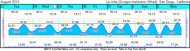
Hot enough for you?   My electricity bill is jumping logarithmically as I type and my AC keeps me cool.  Unfortunately it looks like things are going to stay pretty much the same for the next week with mostly sunny skies, a few morning and evening clouds (for nice sunsets!) and air temps in the low 80s along the coast.  As that Hurricane Kiko turns into a tropical storm and moves north it’ll keep our humidity levels up there.  Winds will remain about the same too…very mild with calm glassy mornings and a little breeze in the afternoon.  Water temps are staying cool in the mid60s and some cooler temps in the southern end of our county.  We’re starting to see some big tide swings as we move into next week and the upcoming new moon.  The biggest swings are overnight so we won’t see them but come Tuesday and into Wed we’ll see a pretty full mid morning high tide drop to a decent low mid-afternoon and then zip back up to a big high a few hours after sunset. 

Looks like some smaller but still fun surf to be had for the upcoming week.  Anything to keep up in the ocean eh?

Stay wet San Diego!
Mish
Thursday's sunset...a real doozy!


Tides for La Jolla (Scripps Institution Wharf) starting with September 1, 2013.

www.saltwatertides.com
Day        High      Tide  Height   Sunrise    Moon  Time      % Moon
           /Low      Time    Feet    Sunset                    Visible
 
Su   1      Low   1:53 AM     0.4   6:24 AM    Rise  2:57 AM      19
     1     High   8:22 AM     4.0   7:14 PM     Set  4:48 PM
     1      Low   1:28 PM     2.1
     1     High   7:35 PM     5.3
 
M    2      Low   2:20 AM     0.2   6:25 AM    Rise  3:51 AM      12
     2     High   8:43 AM     4.3   7:12 PM     Set  5:25 PM
     2      Low   2:03 PM     1.7
     2     High   8:10 PM     5.5
 
Tu   3      Low   2:46 AM     0.1   6:25 AM    Rise  4:46 AM      6
     3     High   9:05 AM     4.6   7:11 PM     Set  6:00 PM
     3      Low   2:36 PM     1.5
     3     High   8:44 PM     5.6
 
W    4      Low   3:12 AM     0.1   6:26 AM    Rise  5:42 AM      2
     4     High   9:29 AM     4.8   7:10 PM     Set  6:34 PM
     4      Low   3:10 PM     1.2
     4     High   9:18 PM     5.6
 
Th   5      Low   3:38 AM     0.2   6:27 AM    Rise  6:39 AM      0
     5     High   9:54 AM     5.1   7:08 PM     Set  7:08 PM
     5      Low   3:44 PM     0.9
     5     High   9:52 PM     5.4
 

Monday, August 26, 2013

Small SW swell coming!

Yes, it’s Monday!  So the way the models are shaping up right now it looks like we should see some SW swell making it’s way to shore by late Wed and things should pick up into the waist high range for Thursday with Friday seeing the peak of the swell and the occasional chest high set.  That swell should start to taper but then we’ll see some activity from a tropical storm that forming down off Mainland Mex. Looks like it’ll be a steep S but hopefully there’s enough energy that we will get some waist high waves from it through most of the Labor Day weekend (Saturday and Sunday).  Monday it looks like we’ll be interrupted by more NW windswell but surf will stay in generally the same range…waist high.

As far as this subtropical moisture is concerned get used to it.  Looks like it’ll be sticking around for the upcoming week.  Expect temps in the mid to upper 70s thru the weekend and high humidity.  As chances of coastal thunderstorms taper off tonight expect mostly sunny skies through Friday.  Clouds build Friday night but clear by mid-morning on both Sat and Sun with clear skies expected for Labor Day.  Expect pretty mild winds all week as well.  We’ll see glassy morning sliding conditions with some mild WNW winds by midday thru the holiday weekend.  Tides aren’t doing much as we are coming off that full blue moon last week.  Medium low I the morning heads to a medium high in the early afternoon before going back out after sunset.  Less and less difference in tides as we end the week.  Water temps have chilled down a little again too…mid to low 60s are our temps these days.  UGH!

Well, at least we’ll see a little swell!
Stay wet San Diego!
Mish

Ocean Notes:

Gotta love a place called "Cow Bombies"!!!!  The Mavs of Oz!  Thanks Surfline!  

Tonight's Sunset in Cardiff by the Sea, CA

Tides for La Jolla (Scripps Institution Wharf) starting with August 26, 2013.

www.saltwatertides.com
Day        High      Tide  Height   Sunrise    Moon  Time      % Moon
           /Low      Time    Feet    Sunset                    Visible
 
M   26     High   1:28 AM     3.7   6:20 AM     Set 12:04 PM      74
    26      Low   6:58 AM     1.9   7:21 PM    Rise 10:58 PM
    26     High   1:36 PM     4.9
    26      Low   8:37 PM     1.5
 
Tu  27     High   2:51 AM     3.1   6:21 AM     Set 12:59 PM      64
    27      Low   7:45 AM     2.4   7:20 PM    Rise 11:41 PM
    27     High   2:35 PM     4.6
    27      Low  10:11 PM     1.5
 
W   28     High   5:07 AM     3.0   6:21 AM     Set  1:51 PM      55
    28      Low   9:02 AM     2.8   7:19 PM
    28     High   3:51 PM     4.5
    28      Low  11:43 PM     1.3
 
Th  29     High   6:54 AM     3.3   6:22 AM    Rise 12:26 AM      45
    29      Low  10:42 AM     2.9   7:17 PM     Set  2:40 PM
    29     High   5:08 PM     4.6
 
F   30      Low  12:42 AM     1.0   6:23 AM    Rise  1:14 AM      36
    30     High   7:35 AM     3.6   7:16 PM     Set  3:26 PM
    30      Low  11:58 AM     2.7
    30     High   6:09 PM     4.8
 

Sunday, August 25, 2013

SW swell on it's way!

Shorty tonight…extended version tomorrow…


Small for Monday, Tuesday and into Wednesday with a new SW building late Wed.  Surf looks to bump up into the waist high range for Thursday and even some waist/chest for Friday at the better south facing spots!  Swell peaks midday Friday and then tapers off Sat with waist high wave before the next swell starts to show.  This next swell is not a good angle for us though so I’m anticipating very little surf from this.  Probably waist high at best with some background WNW windswell.


It’s going to feel a bit like summer over the next few days with some humid, warm and sunny days with very little wind.  We’ve got some subtropical weather in the neighborhood so we may have some thunderstorms along the coast (29-30% chance) until Tues night.


More details Monday night…


Stay wet San Diego!


Mish

Tides for La Jolla (Scripps Institution Wharf) starting with August 26, 2013.

www.saltwatertides.com
Day        High      Tide  Height   Sunrise    Moon  Time      % Moon
           /Low      Time    Feet    Sunset                    Visible
 
M   26     High   1:28 AM     3.7   6:20 AM     Set 12:04 PM      74
    26      Low   6:58 AM     1.9   7:21 PM    Rise 10:58 PM
    26     High   1:36 PM     4.9
    26      Low   8:37 PM     1.5
 
Tu  27     High   2:51 AM     3.1   6:21 AM     Set 12:59 PM      64
    27      Low   7:45 AM     2.4   7:20 PM    Rise 11:41 PM
    27     High   2:35 PM     4.6
    27      Low  10:11 PM     1.5
 
W   28     High   5:07 AM     3.0   6:21 AM     Set  1:51 PM      55
    28      Low   9:02 AM     2.8   7:19 PM
    28     High   3:51 PM     4.5
    28      Low  11:43 PM     1.3
 
Th  29     High   6:54 AM     3.3   6:22 AM    Rise 12:26 AM      45
    29      Low  10:42 AM     2.9   7:17 PM     Set  2:40 PM
    29     High   5:08 PM     4.6
 
F   30      Low  12:42 AM     1.0   6:23 AM    Rise  1:14 AM      36
    30     High   7:35 AM     3.6   7:16 PM     Set  3:26 PM
    30      Low  11:58 AM     2.7
    30     High   6:09 PM     4.8


Thursday, August 22, 2013

Hiccup of S, then a bit more


There’s a light at the end of the tunnel…and it’s been a long tunnel!!!  We’re looking at a small new S swell to fill in for Friday Funday.  Don’t expect miracles but look for the occasional waist high wave at a south facing beach near you.  Waves stay in the knee to waist range all day then tapers off Sat with the ever lingering NW wind swell on top.  Sunday we’ll see more knee high surf with a bit more NW wind swell Monday.  There could be the occasional waist/chest high wave from the Tropical Depression “Nine” that’s heading our way but the angle is really aimed SE which means it should mostly fly right past us.  The more northerly summer breaks might catch a hint of it.   Otherwise, surf in the knee/waist high range with shorter periods from the windswell.  Tues and Wed is looking knee high again BUT Thursday looks like we’ll have some new SW groundswell and it might actually bump our swell past the waist high range.  We might actually see some chest high surf from this one.  It’s still a week away so we’ll have to see what happens to the storm creating this swell.  Think positive!!!

Speaking of Friday Funday we’re looking at a mighty fine beach day Friday with sunny skies, lots of heat and humidity too!  There’s a wee tropical depression down south that’s making its way towards us and pushing the clouds away and bumping up the tropical humidity for a few days.  Friday and Sat look for mostly sunny skies and air temps in the mid to high 70s.  Sunday and the rest of the week should be in the mid 70s with a few more clouds until Tues then clear skies and sunshine!  We could have a thundershower or two and maybe even the random hail Sunday night and thru Monday but those models are backing off so we might just have some cool looking thunderheads.  Water temps are all over the map with warm water in the low 70s in the northern end of the county and some chilly mid to low 60 degree water down south.  Tides are swinging a lot with the Blue Moon we had last night.  We’re looking at a zero tide an hour before sunrise moving up to a pretty high tide midday and then back out again for the sunset session (good for a Friday evening walk on the beach!) and then back up to a high around midnight. 

Looks like some tiny waves for the gorgeous weekend but hopefully something on the way for the Labor Day weekend!

Stay wet San Diego!
Mish

Ocean Notes:
1)  Tahiti has been seeing some fun waves for the Billabong Pro…nothing monstrous but perfect, beautiful and pro surfers ripping them left and right…well, left anyway.  Check out Adrian Buchan  as he takes out Slater in the finals!

2) Surfrider’s at it again. Always cleaning up our beaches!  Go ahead and join in the fun this weekend in PB!  Click here for more info and details on other beach clean ups this fall!

3)  One of the greatest super foods for surfers to power up before or after a great surf session is beans.  “Bean, beans…good for the heart…” isn’t that how it goes?  Anyway, Treehugger  has some great recipes for beans and lentils.  Fuel up before paddling out!

4)  If you are looking to kill some time check out photographer Rob Gilley’s blog on Surfer Mag’s site.  Not only are there some great photos but some interesting insight as to how surfing has touched people all over the world…how the stoke has fueled folks in all walks of life and in tough times.  Check it out!

5)  This Sunday is the Leucadia Artwalk  from 10am – 5pm.  One of the cool local artists owns Swell Stuff wetsuit sales and repair.  Check out the swell hand knit beanies and other surf accessories while you’re in there.  Wetsuits on sale, consignment shop and even wetsuit recycling!!!  And bonus…local artist Golden Poppy Design  will be at Swell Stuff too!  Awesome handcrafted jewelry from local surfer girl Poppy deAnda.

6)  And to end on something totally surfy…Jon Jon and Buchan in Tahiti…doesn’t get much more surfy  than that right now!


Tides for La Jolla (Scripps Institution Wharf) starting with August 23, 2013.

www.saltwatertides.com
Day        High      Tide  Height   Sunrise    Moon  Time      % Moon
           /Low      Time    Feet    Sunset                    Visible
 
F   23      Low   5:09 AM     0.0   6:18 AM     Set  9:05 AM      95
    23     High  11:28 AM     5.4   7:25 PM    Rise  9:01 PM
    23      Low   5:32 PM     0.7
    23     High  11:40 PM     5.0
 
Sa  24      Low   5:44 AM     0.6   6:19 AM     Set 10:07 AM      90
    24     High  12:07 PM     5.3   7:24 PM    Rise  9:38 PM
    24      Low   6:24 PM     1.0
 
Su  25     High  12:29 AM     4.3   6:19 AM     Set 11:06 AM      82
    25      Low   6:20 AM     1.3   7:22 PM    Rise 10:17 PM
    25     High  12:48 PM     5.2
    25      Low   7:23 PM     1.2
 
M   26     High   1:28 AM     3.7   6:20 AM     Set 12:04 PM      74
    26      Low   6:58 AM     1.9   7:21 PM    Rise 10:58 PM
    26     High   1:36 PM     4.9
    26      Low   8:37 PM     1.5
 
Tu  27     High   2:51 AM     3.1   6:21 AM     Set 12:59 PM      64
    27      Low   7:45 AM     2.4   7:20 PM    Rise 11:41 PM
    27     High   2:35 PM     4.6
    27      Low  10:11 PM     1.5
 

Monday, August 19, 2013

Light at the end of the tunnel???

Not a lot of news as far as swells go.  The Southern Pacific is just barely breathing in terms of swell for our swell window. Mainland Mex is finally getting some much needed surf but we’ll be seeing just a hint of SW swell starting Tuesday.  Long period SW waves in the knee/thigh high range with some lumpy NW windswell on top of it.  That’s the story for Wednesday and early Thursday too.  Swell tapers off as more NW windswell sticks around for later Thurs and into Fri.  Very late Friday a very steep S will start to fill in.  I’m thinking it will pass SD County by but the occasional knee/thigh high wave will appear at the better south facing spots for Saturday.  The better news is that a slightly stronger swell should fill in and peak Sun and into Monday.  Don’t get the big guns out just yet.  This is another steep south but with a little more energy we should see some better signs of life in the waist high range at the best summer spots.  We’ll also see some NW windswell sticking around town.


The interesting news besides almost zero surf for several weeks now is that it’s kind of chilly along the coast.  Things are about to change.  Patchy coastal marine layer/fog will linger in the early AM but air temps will be in the low 70s warming up to the high 70s by Thursday and then dropping a little into the weekend.  Wind wise it looks like a NW wind will stick around for the next few days with breezes through the night thru Thursday.  Tides are starting to swing as we hit the full moon Wed night.  We’ll see a fairly full mid-morning high tide going out to a pretty low tide mid-afternoon before racing up to a big high tide a few hours after sunset.  Water temps still fluctuating with some much cooler temps in the low 60s in the southern part of town and high 60s for the northern end of town.


Looks like there might be some activity for us in about a week!  Keep your fingers crossed and stay wet San Diego!


Mish


Tides for La Jolla (Scripps Institution Wharf) starting with August 20, 2013.

www.saltwatertides.com
 
Day        High      Tide  Height   Sunrise    Moon  Time      % Moon
           /Low      Time    Feet    Sunset                    Visible
 
Tu  20      Low   3:20 AM    -1.0   6:16 AM     Set  5:50 AM      97
    20     High   9:39 AM     5.1   7:28 PM    Rise  7:06 PM
    20      Low   3:11 PM     0.9
    20     High   9:25 PM     6.4
 
W   21      Low   3:57 AM    -0.9   6:17 AM     Set  6:57 AM      99
    21     High  10:15 AM     5.3   7:27 PM    Rise  7:46 PM
    21      Low   3:58 PM     0.7
    21     High  10:10 PM     6.2
 
Th  22      Low   4:33 AM    -0.5   6:17 AM     Set  8:02 AM      99
    22     High  10:51 AM     5.4   7:26 PM    Rise  8:24 PM
    22      Low   4:44 PM     0.6
    22     High  10:55 PM     5.6
 
F   23      Low   5:09 AM     0.0   6:18 AM     Set  9:05 AM      95
    23     High  11:28 AM     5.4   7:25 PM    Rise  9:01 PM
    23      Low   5:32 PM     0.7
    23     High  11:40 PM     5.0
 
Sa  24      Low   5:44 AM     0.6   6:19 AM     Set 10:07 AM      90
    24     High  12:07 PM     5.3   7:24 PM    Rise  9:38 PM
    24      Low   6:24 PM     1.0


Wednesday, August 14, 2013

More flat...then a smidge of swell...

Oooooooooooooh boy!  Mother Nature is just not interested in sending us any wave love!  We’re looking at some calf high surf for the next few days with just a hint of SW swell filling in late Friday and into Saturday and Sunday.  Background WNW wind swell will be around too but just enough to create a little white water to splash around in.  Late Friday looks like surf goes from calf to knee high, solid knee high sets by Saturday morning and peaking swell on Sunday with thigh/waist high waves.  (I tried to make that sound glamorous…did it work?)  Monday swell drops back into the waist/knee high range and backs off further Tuesday.  A steep S aimed more at Mainland Mex will grace our buoys late Tuesday on into Wed but I’m thinking that swell will pass right by most of SD County.  Only the best summer spots will really see much of that…and by “much” I mean knee/waist high.  Hoping these doldrums wear off soon cause my arms are gonna be noodles this winter if this keeps up!

Weather pattern looks like it’ll start trying to clear up at the coast a bit more after with a bit more sunshine midday. Air temps look to warm up a few degrees along the coast with more sunshine for a few days before we head into the weekend.  Mid 70s for Thurs and Friday then low to mid 70s for the weekend with morning and nighttime clouds.  Pretty mild winds…so we’re talking Lake Pacific out there.  The water’s holding in the mid to upper 60s.  Water clarity is pretty awesome so a snorkel and mask might be your best bet at the beach this week.  Tides aren’t doing much in the first half of the next few days but then starts to swing a bit more in the afternoon as we get closer to the Full Moon early next week.

The beach is still a beautiful place to be this week!  Go enjoy it and paddle your board around with a snorkel and mask and see what’s going on under water!

And don’t forget…stay wet San Diego!
Mish


Tides for La Jolla (Scripps Institution Wharf) starting with August 15, 2013.

www.saltwatertides.com
Day        High      Tide  Height   Sunrise    Moon  Time      % Moon
           /Low      Time    Feet    Sunset                    Visible
 
Th  15     High   5:35 AM     3.0   6:13 AM     Set 12:31 AM      54
    15      Low   9:56 AM     2.5   7:34 PM    Rise  2:50 PM
    15     High   4:52 PM     5.3
 
F   16      Low  12:19 AM     0.3   6:13 AM     Set  1:26 AM      65
    16     High   6:54 AM     3.4   7:33 PM    Rise  3:50 PM
    16      Low  11:26 AM     2.4
    16     High   6:00 PM     5.7
 
Sa  17      Low   1:14 AM    -0.2   6:14 AM     Set  2:28 AM      76
    17     High   7:44 AM     3.9   7:32 PM    Rise  4:46 PM
    17      Low  12:36 PM     2.1
    17     High   6:59 PM     6.2
 
Su  18      Low   1:59 AM    -0.7   6:15 AM     Set  3:34 AM      85
    18     High   8:25 AM     4.3   7:31 PM    Rise  5:37 PM
    18      Low   1:33 PM     1.6
    18     High   7:51 PM     6.4
 
M   19      Low   2:41 AM    -1.0   6:15 AM     Set  4:41 AM      93
    19     High   9:02 AM     4.7   7:29 PM    Rise  6:24 PM
    19      Low   2:24 PM     1.2
    19     High   8:40 PM     6.6
 

Sunday, August 11, 2013

Small all week!

Don’t hate the messenger but…it’s going to be small…for awhile.  We’re coming off a small SW but Monday with flat to ankle high waves.  There might be a left over waist high wave here or there at the better south facing summer spots.  That will be the story for the majority of the week.  We’ll see some very small SW swell in the knee high range late Monday and Tuesday and then the rest of the week will be ankle/knee high WNW short period wind swell  until Friday. Then we’ll see a little boost in NW swell…emphasis on “little” with some potential for thigh high waves for the weekend.  There just isn’t really much activity going on in either hemisphere to send us any swell.  There is one decent looking storm forecasted for the end of next week but any swell generated from that wouldn’t reach us for another week and a half…or so.

I guess the good news is that it’s going to be really nice along the coast with some high pressure building in and a bit more sunshine.  We’ll still see some early morning clouds but things will warm up into the high 60s/low 70s Mon and Tues with mid/upper 70s for the end of the week and into the weekend.  Winds look to be pretty light all day with a cool breeze out of the west by midday each day this week.  Tides are in between moon phases as we move away from the new moon so we’re seeing a medium low in the early morning with a medium high in the early afternoon and moving back down to another medium low just after sunset.  Water temps are still on the cool side as these WNW/NW wind swells keep things cool.  The northern half of the county is looking at high 60s with the occasional 70 degree reading here and there.  The southern half of the county is staying cool with mid to low 60s.

The good news is that there is still plenty to do in a flat ocean!  Head out to the kelp and go fishing, snorkel your favorite reef break, or paddle out to La Jolla Cove to visit with a few hundred leopard sharks (they’re harmless!).  It’s going to be a gorgeous week to be at the beach…just no surf.

Stay wet San Diego!
Mish


 Dug this out of the archives...Feb. 2008...guess where?


Tides for La Jolla (Scripps Institution Wharf) starting with August 12, 2013.

Day        High      Tide  Height   Sunrise    Moon  Time      % Moon
           /Low      Time    Feet    Sunset                    Visible
 
M   12     High  12:45 AM     4.0   6:11 AM    Rise 11:44 AM      23
    12      Low   6:38 AM     1.4   7:37 PM     Set 10:57 PM
    12     High   1:25 PM     4.9
    12      Low   8:09 PM     1.6
 
Tu  13     High   1:56 AM     3.3   6:11 AM    Rise 12:45 PM      32
    13      Low   7:17 AM     1.8   7:36 PM     Set 11:41 PM
    13     High   2:23 PM     5.0
    13      Low   9:39 PM     1.4
 
W   14     High   3:41 AM     2.9   6:12 AM    Rise  1:48 PM      43
    14      Low   8:19 AM     2.2   7:35 PM
    14     High   3:35 PM     5.1
    14      Low  11:09 PM     1.0
 
Th  15     High   5:35 AM     3.0   6:13 AM     Set 12:31 AM      54
    15      Low   9:56 AM     2.5   7:34 PM    Rise  2:50 PM
    15     High   4:52 PM     5.3
 
F   16      Low  12:19 AM     0.3   6:13 AM     Set  1:26 AM      65
    16     High   6:54 AM     3.4   7:33 PM    Rise  3:50 PM
    16      Low  11:26 AM     2.4
    16     High   6:00 PM     5.7