Sunday, September 28, 2014

Dominant SW with some NW too!


OK well we’ve got both hemispheres opening up and throwing swells in our direction plus yet another hurricane chilling off Baja.  To kick off the work week we’re looking at the left overs of the WNW windswell that’s making things kinda funky and not as clean as they should be (plus a bit of wind lately).  Hurricane Rachel is spinning just due west of the tip of Cabo and sending some steep SE swell our way.  I doubt if most of SD will see any of this but OC should pick some of it up.  The best summer spots in SD will see a bump up of some waist high waves for the day and OC looks to capture some waist/chest high waves as some of that hurricane swell may wrap in.  Tuesday a bit more of the same with energy backing off but a touch better angle so a little more in the OC/SD swell window.   Wednesday things back off for the day.  This will be the smallest day of the week with waist high waves for both SD and OC/LA.  The second half of the day will probably see some SW sneaking in with some waist high waves. 

Thursday is the bigger story with a new dominant SW groundswell that will be rolling in and bumping things up towards the end of the day into to the chest/shoulder high range with good angle for SD and OC/LA.  Super inconsistent to start off of course (southern hemi swells take their time).   Swell holds through Friday and Saturday and conditions should be really hot and nice all day (so play nicely!).  The consistency will be better too.  Sunday things start to back off but we’ll still see plenty of chest high waves but energy level will taper off.  Kicking off the next week we should see some new NW groundswell arriving.  The best news is that there are both NW and SW groundswells that look to be forming and heading our way for that week.  Still lots of energy out there in the southern hemi…don’t count it out yet! 

And I hope you’re all enjoying the nice cool Fall air temps because that’s all about to change as we slide into another warming trend.  Patchy fog in the mornings and evenings give way to sunny skies and air temps in the mid/high 70s thru Wed and then clear skies and low/mid80s for the end of the week and thru the weekend.  We’re looking at some E winds tonight (Sunday) turning W and a bit blustery in the morning as it has the past few days.  I’d get on it ASAP for the best conditions.  We’ll see a similar pattern for the next few days…offshore overnight and onshore early.  Water temps are cooling down with some high 60s around most of town.  The medium low tide at first light fills in to a high midday and back out a few hours after sunset.

Looks like yet another fun week of September Sessions!  Fall is in the air!  Surf is going off around the planet and the full suits are coming out of the closets.  Enjoy the surf this week!

Stay wet So Cal!
Mish 


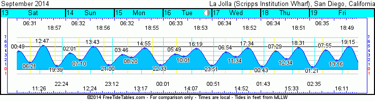
Tides for La Jolla (Scripps Institution Wharf) starting with September 29, 2014.

www.saltwatertides.com
Day        High      Tide  Height   Sunrise    Moon  Time      % Moon
           /Low      Time    Feet    Sunset                    Visible
 
M   29     High   1:02 AM     3.5   6:42 AM    Rise 11:44 AM      20
    29      Low   5:47 AM     2.3   6:36 PM     Set 10:29 PM
    29     High  12:25 PM     5.1
    29      Low   7:52 PM     1.0
 
Tu  30     High   2:28 AM     3.2   6:43 AM    Rise 12:41 PM      29
    30      Low   6:36 AM     2.7   6:35 PM     Set 11:24 PM
    30     High   1:29 PM     4.9
    30      Low   9:15 PM     1.0
 
W    1     High   4:16 AM     3.3   6:43 AM    Rise  1:35 PM      39
     1      Low   8:22 AM     3.0   6:34 PM
     1     High   3:00 PM     4.7
     1      Low  10:37 PM     0.7
 
Th   2     High   5:38 AM     3.7   6:44 AM     Set 12:23 AM      50
     2      Low  10:22 AM     2.8   6:32 PM    Rise  2:26 PM
     2     High   4:33 PM     4.8
     2      Low  11:42 PM     0.4
 
F    3     High   6:27 AM     4.1   6:45 AM     Set  1:26 AM      61
     3      Low  11:44 AM     2.3   6:31 PM    Rise  3:14 PM
     3     High   5:48 PM     5.2

Monday, September 22, 2014

The Northern Hemi stirs...


With the last day of Summer as we transition into Fall I’ll report that the northern hemisphere is waking up and I think things are going to cool off a little faster than we’d all like. Then again, if it brings on some nice winter swells then I don’t think we’ll be doing much complaining.  The second half of this summer has been pretty nice!  In the short term, while the hemispheres are transitioning and trying to figure out if it’s summer or winter it’s just going to be kind of small and messy for the next few days.  We’ve got some WNW windswell Tuesday with some background SW groundswell that’s not really aimed directly at our window but we’ll get some residuals either way.  Look for waist high waves at most beaches as both swells roll thru town.  

Wednesday looks for more of the same  and then by Thursday it looks like we’ll start seeing a little more of another shorter period WNW groundswell  start to fill in. Waves bump up a smidge at the better West and NW facing beaches with some waist/chest high waves by nightfall.  About the same for Friday and slightly smaller waves for Sat and Sun and the swell tapers off. Monday looks like the last of the WNW with knee/waist high waves.  There’s a small SW that should show at the summer spots in the knee high range…so really not much.  The good news is that a pretty decent storm looks to roll out from behind New Zealand and send us a nice shot of late southern hemi ground swell late next week.  There’s also a bit more activity brewing in the NW Pacific and even a new tropical depression down off of Mainland Mex.

The weather looks to remain about the same for the next week with air temps bumping up a bit into the high 70s along the coast and starting each day with some clouds.  The best part is the slightly cooler fall evenings.  Nighttime temps in the mid 60s.  Winds look fairly predictable with mostly calm winds in the morning picking up out of the NW by the afternoon.  Things clear up and heat up next week so enjoy the cool for now.  Tides are swinging a lot through the day as we have the New Moon Wednesday night.  We’ll see a big high tide slow things down mid-morning, draining out to about a 0.5’ low late afternoon.  Water temps are definitely cooling down in some spots.  North County, OC and LA are still decently warm in the mid-70s still but there are some cooler low 70s/high 60s down past La Jolla and Pt. Loma.

Looks like some ok surf…enough to keep you paddling and in the water.

Stay wet So Cal!
Mish


Tides for La Jolla (Scripps Institution Wharf) starting with September 23, 2014.

Day        High      Tide  Height   Sunrise    Moon  Time      % Moon
           /Low      Time    Feet    Sunset                    Visible
 
Tu  23      Low   3:08 AM     0.6   6:38 AM    Rise  6:07 AM      1
    23     High   9:23 AM     5.2   6:44 PM     Set  6:27 PM
    23      Low   3:24 PM     0.8
    23     High   9:31 PM     5.2
 
W   24      Low   3:32 AM     0.7   6:39 AM    Rise  7:01 AM      0
    24     High   9:47 AM     5.3   6:43 PM     Set  7:00 PM
    24      Low   3:56 PM     0.6
    24     High  10:04 PM     5.0
 
Th  25      Low   3:57 AM     0.9   6:39 AM    Rise  7:56 AM      0
    25     High  10:12 AM     5.4   6:42 PM     Set  7:35 PM
    25      Low   4:31 PM     0.5
    25     High  10:39 PM     4.7
 
F   26      Low   4:22 AM     1.2   6:40 AM    Rise  8:52 AM      2
    26     High  10:39 AM     5.4   6:40 PM     Set  8:12 PM
    26      Low   5:08 PM     0.6
    26     High  11:18 PM     4.3
 
Sa  27      Low   4:47 AM     1.6   6:41 AM    Rise  9:49 AM      6
    27     High  11:08 AM     5.3   6:39 PM     Set  8:53 PM
    27      Low   5:51 PM     0.7

Tuesday, September 16, 2014

Nice SW filling in!


Well, we have swell all over the place!  That nice new SW is steamrolling its way into town Wednesday morning.  It is, however, a groundswell so it’s not super consistent yet but when the sets come…you’d better be ready!  I saw 5-6 waves in a set this evening!  Waves throughout SD county in the HH/OH+ (6-8’ faces) range with bigger sets rolling through parts of OC and LA.  Some of Northern LA will get some island shading but most of So Cal is seeing surf.  It’s being accompanied by a WNW swell that will fill in more late Wed and into Thursday.  Better consistency from this SW swell later Wed as the swell peaks but size remains about the same. Thurs the SW drops off a little and more WNW fills in.  It’s shorter period so it may just put some bump on the SW waves.  Friday both swells drop to chest/shoulder in the morning and tapering off to waist/chest by nightfall.  Sat and Sunday will see smaller SW surf…waist high…with still some lingering WNW.  Late Sun and into Monday there’s a hint of SW but it’s not really aimed at our window so waves will be inconsistent and in the waist high range at best.  By Tuesday it looks like Hurricane Polo, the next storm will be sending waves by us.  It doesn’t look like Polo will deliver however as it’s hugging below Cabo and shooting swell NW of us.  I don’t even think OC and LA will see much of this one.  After some quiet time it looks like both hemis are gonna deliver more surf.  Head to and island in the Pacific (northern or southern) for the best stuff!

 The big news is the weather!  It was crazy in some party of San Diego County!  Crazy 60-70mph winds with driving sheet sideways rain and down trees everywhere.  We can thank Hurricane Odile who just decimated Cabo San Lucas and most of Baja California for that little surprise.  The good news is that the air temps should really decrease over the next few days. We’re looking at low/mid 80s along the coast for Wed and low/mid 70s by Friday. Mostly sunny with some patchy fog in the early early morning.  The bad news is that the humidity will stay and things will heat back up next week.  Light offshores for Wed AM but otherwise W in the afternoon and then S winds kicking in Wed night and into Thursday  before turning west again in the afternoon.  Mostly light winds however so nothing to fret too much about.  No thunderheads, lightning storms or torrential rain in the forecast.  Tides are fairly flat during daylight hours with extreme tides overnight.  Very little push or drainage for the next few days until the weekend.   Water temps still in the low 70s along the coast…more south swell should mean more warm water (and awesome fishing!).

Looks like a few fun days of surf coming up!  Stay hydrated, surf your brains out and don’t forget to share!  Live Aloha!

Mish


New swell filling in!
  
Tides for La Jolla (Scripps Institution Wharf) starting with September 17, 2014.
www.saltwatertides.com
Day        High      Tide  Height   Sunrise    Moon  Time      % Moon
           /Low      Time    Feet    Sunset                    Visible
 
W   17     High   6:52 AM     3.8   6:34 AM    Rise 12:51 AM      42
    17      Low  11:35 AM     2.8   6:53 PM     Set  2:53 PM
    17     High   5:35 PM     4.6
 
Th  18      Low  12:44 AM     0.7   6:35 AM    Rise  1:43 AM      33
    18     High   7:29 AM     4.0   6:51 PM     Set  3:34 PM
    18      Low  12:34 PM     2.4
    18     High   6:32 PM     4.8
 
F   19      Low   1:22 AM     0.6   6:35 AM    Rise  2:35 AM      24
    19     High   7:55 AM     4.3   6:50 PM     Set  4:12 PM
    19      Low   1:16 PM     2.0
    19     High   7:16 PM     5.0
 
Sa  20      Low   1:52 AM     0.5   6:36 AM    Rise  3:28 AM      16
    20     High   8:17 AM     4.5   6:48 PM     Set  4:47 PM
    20      Low   1:50 PM     1.6
    20     High   7:53 PM     5.2
 
Su  21      Low   2:19 AM     0.5   6:37 AM    Rise  4:20 AM      10
    21     High   8:38 AM     4.8   6:47 PM     Set  5:21 PM
    21      Low   2:22 PM     1.3
    21     High   8:26 PM     5.2
 

Friday, September 12, 2014

Endless summer (and hurricanes) rolls on...


Hola!  A little quiet time to let y’all rest before the ocean starts pumping again.  We’re looking at fading SW swell with a bit of WNW windswell on top of it for Saturday.  Waves in the waist high range at most beaches with very little energy and pretty funky.  Sunday is smaller with super low energy S.  Monday will also be uber tiny with just some super steep S that will miss most of So Cal with OC and LA seeing the only real swell.  Look for knee/waist high at best.  Tuesday we will see the very first signs of life will start to show with some SW combo’d w WNW windswell.  Surf picks up to chest high throughout the day.   You will some long-period SW groundswell in there.  Surf should light up around town as this SW groundswell fills in.  The angle is good for So Cal so breaks all over SD, OC and LA will benefit with the better summer breaks seeing the biggest waves of course.  The groundswell will be given a boost as  a more consistent Hurricane Odile starts to fill in.  This hurricane is tracking straight up the Baja Peninsula.  The angle isn’t ideal if Odile was cruising by herself but with the combo Southern Hemi swell it’s going to make for some fun surf. 

By Wed we’re looking at shoulder/HH surf by nightfall and Thursday will be the peak of the swell with San Diego seeing HH and some OH waves at the best spots.  OC and LA will see HH/OH+ waves by Wed night and into Thursday as the Odile moves closer to SD and the Southern Hemi peaks.  Friday will still see the swells back off a little but still plenty of fun waves.  As the southern hemi backs off SD will see less of Odile as it will be pretty steep but OC/LA will still be getting chest/HH waves through the first half of the day.  Swells back off a lot through the day.  It looks like things quiet down as little.  There’s activity in both hemispheres but the southern hemis aren’t direct hits for So Cal (more mainland Mex) and a little activity looks like it might be brewing on the other side of the Pacific Ocean. Stay tuned!


The big news is the heat and humidity we’re about to get smacked with!  Hot days are upon us with beach temps in the mid to high 80s this weekend and even low 90s to kick off the work week.  No clouds thru the weekend but as Odile marches up the Baja Peninsula she’s gonna be dragging some humidity and clouds with her.  By Tues we should see some clouds and the air temps will drop back into the low 80s by the end of the week.  The forecast is showing more heat for the end of next weekend though.  We’ll just have to see how that develops.   Watch those tide swings too because they’ll make a big difference.  We’ll see a moderate swing and then much less tidal movement as we move through the week.  Medium low early morning rising up to a pretty high tide midday and then racing back out for the sunset session.  Beach water temps are in the low 70s up and down the coast.  With the hurricane swell we may see some upwelling and temps cool a little more but hopefully the southern hemi will keep pushing the warm stuff up.  Interestingly enough, the uber warm water is actually going to allow Odile to get pretty close to us here in SD.  The forecast shows her hugging the Baja coastline all the way up.  We could have some interesting weather!  Or just more muggy heat.  We can complain, this isn’t NY!

The endless summer rolls on!  Stay wet So Cal!

Mish


Tides for La Jolla (Scripps Institution Wharf) starting with September 13, 2014.

www.saltwatertides
Day        High      Tide  Height   Sunrise    Moon  Time      % Moon
           /Low      Time    Feet    Sunset                    Visible
 
Sa  13     High  12:49 AM     4.1   6:32 AM     Set 11:26 AM      81
    13      Low   6:20 AM     1.6   6:58 PM    Rise 10:24 PM
    13     High  12:46 PM     5.3
    13      Low   7:39 PM     0.8
 
Su  14     High   2:02 AM     3.6   6:32 AM     Set 12:24 PM      72
    14      Low   7:09 AM     2.2   6:57 PM    Rise 11:11 PM
    14     High   1:42 PM     5.0
    14      Low   8:59 PM     1.1
 
M   15     High   3:47 AM     3.3   6:33 AM     Set  1:18 PM      62
    15      Low   8:21 AM     2.7   6:55 PM
    15     High   2:54 PM     4.7
    15      Low  10:33 PM     1.1
 
Tu  16     High   5:48 AM     3.5   6:34 AM    Rise 12:01 AM      52
    16      Low  10:03 AM     2.9   6:54 PM     Set  2:08 PM
    16     High   4:19 PM     4.5
    16      Low  11:51 PM     0.9
 
W   17     High   6:52 AM     3.8   6:34 AM    Rise 12:51 AM      42
    17      Low  11:35 AM     2.8   6:53 PM     Set  2:53 PM
    17     High   5:35 PM     4.6

Tuesday, September 9, 2014

New SW and our first NW


Just a quickie…new swell building Wednesday out of the SW b midday.  Surf looks to pick up from the waist high range in the morning to the waist/chest high range with some shoulder high sets at the outstanding south facing spots.  By Thursday morning we should also see the addition of the first NW groundswell.  The SW will dominate but some of the W and N facing spots will see a little boost in wave size.  Both swells hold through Friday and start to taper off into Sat.  Looks like some WNW windswell will dominate our weekend.

Some pretty extreme tides this week with yesterday’s Super Full Moon!  Drained out for the dawn patrol and pretty high mid-morning.  The later afternoon drained out low tide will rebound to give a nice little push for the sunset session as that swell fills in.  Hot and sunny with more humidity on the way.  A little upwelling has beach water temps down a few degrees and that NW might push some cooler water our way but it’s still in the low 70s all over So Cal!

More details tomorrow night...but the long term forecast looks promising!  More summer sessions on the way!

Stay wet So Cal!
Mish
 

Tides for La Jolla (Scripps Institution Wharf) starting with September 10, 2014.

www.saltwatertides.com
Day        High      Tide  Height   Sunrise    Moon  Time      % Moon
           /Low      Time    Feet    Sunset                    Visible
 
W   10      Low   4:22 AM    -0.1   6:30 AM     Set  8:15 AM      99
    10     High  10:38 AM     5.9   7:02 PM    Rise  8:13 PM
    10      Low   4:48 PM     0.0
    10     High  11:01 PM     5.4
 
Th  11      Low   5:00 AM     0.4   6:30 AM     Set  9:21 AM      95
    11     High  11:18 AM     5.9   7:01 PM    Rise  8:55 PM
    11      Low   5:39 PM     0.2
    11     High  11:52 PM     4.8
 
F   12      Low   5:39 AM     1.0   6:31 AM     Set 10:25 AM      89
    12     High  11:59 AM     5.7   6:59 PM    Rise  9:38 PM
    12      Low   6:34 PM     0.5
 
Sa  13     High  12:49 AM     4.1   6:32 AM     Set 11:26 AM      81
    13      Low   6:20 AM     1.6   6:58 PM    Rise 10:24 PM
    13     High  12:46 PM     5.3
    13      Low   7:39 PM     0.8
 
Su  14     High   2:02 AM     3.6   6:32 AM     Set 12:24 PM      72
    14      Low   7:09 AM     2.2   6:57 PM    Rise 11:11 PM
    14     High   1:42 PM     5.0
    14      Low   8:59 PM     1.1

Tuesday, September 2, 2014

Happy September Sessions!

Oh goodness…what a few weeks of swell we’ve had!  Lowell and then Marie lit up the coast!  Well, this weekend we’re in for more fun southern hemi groundswell!  Wednesday we’re looking at the smallest day of surf for awhile with waist/chest high waves out of the SW.  We’ll see a small bump up on Thursday with really just more waist/chest waves through the day.  Through the night the next SW groundswell will start to fill in. Friday morning we should see some very inconsistent chest high waves building through the day to shoulder/HH by might fall and some OH sets at the best summer south facing spots.  Saturday will see even more swell and an improvement in consistency as the swell continues to build.  The swell peaks midday on Saturday with HH/OH+ sets especially at the standout spots.  HH/OH waves for the first half of Sunday as the swell starts to fade.  Chest/shoulder high waves by the evening session and chest high to start the next week on Monday and continuing to fade through the day.  Tuesday we may see some energy from Tropical Storm Norbert which is currently tucked down under Baja.  That energy is heading NW but not in our direction so if we see anything I think it will be indirect at best.  The interesting news is that the southern hemi quiets down for a little bit but the northern hemi wakes up early and looks like it will send us a little nugget of WNW swell for later mid/late next week.  I’ll keep my eye on that and Norbert!

We’re still enjoying plenty of summer weather now that there has been a mass exodus from the beaches (YAY!) and school is back in session.  We’ll see cloudy mornings clear to sunny skies and air temps in the mid-70s for the rest of the week.  Light morning breezes make way for the typical mild to moderate westerly winds by the afternoon.  Look for a bit more fog for the weekend mornings and evenings but still plenty of sunshine midday with slightly warmer air temps in the low 80s.  Water temps should remain in the “awesome” category with temps in the mid 70s in SD and low 70s in LA/OC.  Tides are nor moving much midday for the next few days but then we start to see good movement for the weekend as we approach the Full Moon.  Look for a pre-dawn high tide moving slowly out to the mid-morning medium low and back up to the late afternoon high tide push.

Looks like more fun swell for the rest of the work week and some juicy swell for the weekend!  The sandbars should be pretty fun after all of the Hurricane Marie swell we just had!  Happy September Sessions!!! 

Stay wet So Cal!
Mish
 
As Hurricane Marie started to fade 
I managed to snap a few pics at 
a local North County beach break.


 Tides for La Jolla (Scripps Institution Wharf) starting with September 3, 2014.
Day        High      Tide  Height   Sunrise    Moon  Time      % Moon
           /Low      Time    Feet    Sunset                    Visible
 
W    3     High   5:56 AM     3.3   6:25 AM     Set 12:33 AM      54
     3      Low  10:18 AM     2.7   7:11 PM    Rise  2:48 PM
     3     High   4:56 PM     5.1
 
Th   4      Low  12:16 AM     0.4   6:26 AM     Set  1:31 AM      65
     4     High   6:53 AM     3.7   7:10 PM    Rise  3:42 PM
     4      Low  11:43 AM     2.4
     4     High   6:04 PM     5.5
 
F    5      Low   1:05 AM    -0.1   6:26 AM     Set  2:34 AM      75
     5     High   7:34 AM     4.1   7:09 PM    Rise  4:34 PM
     5      Low  12:45 PM     1.9
     5     High   7:01 PM     5.9
 
Sa   6      Low   1:49 AM    -0.5   6:27 AM     Set  3:41 AM      85
     6     High   8:11 AM     4.7   7:07 PM    Rise  5:22 PM
     6      Low   1:37 PM     1.4
     6     High   7:52 PM     6.3
 
Su   7      Low   2:29 AM    -0.7   6:28 AM     Set  4:49 AM      92
     7     High   8:47 AM     5.2   7:06 PM    Rise  6:07 PM
     7      Low   2:26 PM     0.8
     7     High   8:40 PM     6.3